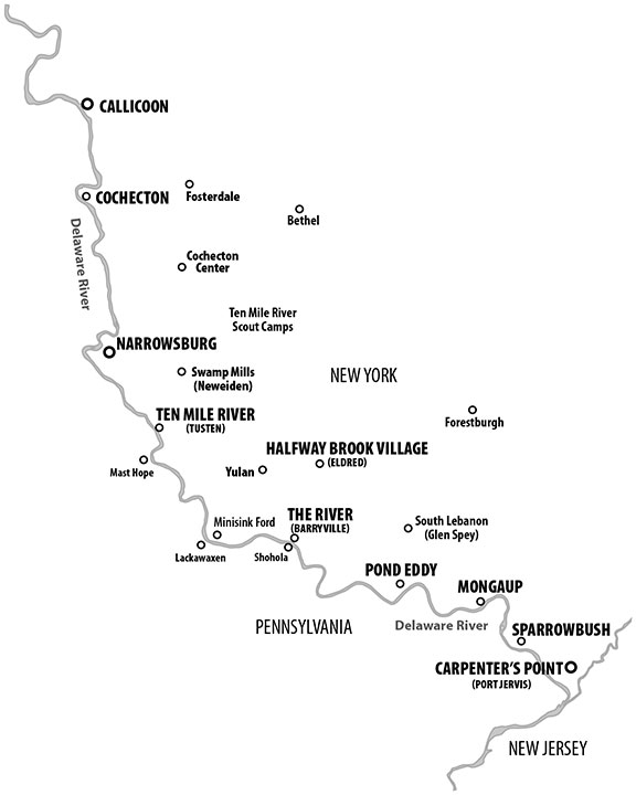
This is basically a repost of October 2009, with the addition of Gary’s helpful map.
Cushetunk/Cochecton: In 1754, Connecticut Yankees established Cushetunk and claimed the Delaware River’s west bank for the Colony of Connecticut. Cochecton (cuh-SHEK-ton), meaning low land, is also called the flats. It is rich and fertile, full of fish and game.
Narrowsburg(h): Narrowsburg (Homan’s Eddy), has the narrowest and deepest points on the Upper Delaware River.
Tusten (Ten Mile River): Tusten at the mouth of the Ten Mile River was first called the Ten Mile River settlement, and grew up around 1751. It was later named for the Revolutionary hero, Dr. Tusten. Ten Mile River is the site of a large summer camp maintained by the Boy Scouts of America.
Shehola, Shohola: Shehola is Lenape for slow waters where the geese rest. The Pennsylvania town Shohola is on the Shohola River directly across from The River or Barryville, New York.
Mongaup: Mongaup is a small, quiet hamlet at the mouth of the Mongaup River, which is still the eastern border of the town of Lumberland.
Sparrowbush: Sparrowbush was named for H.L. Sparrow, a dealer in ship-knee timber. Mr. Sparrow rafted down the Delaware River in the early 1800s.The land was originally named Sparrow’s Bosh. Bosh was a sloping thicket or woods.


